IMD Update: Monsoon withdrawal stalls; fresh ‘low’ looms over Bay in 3 days


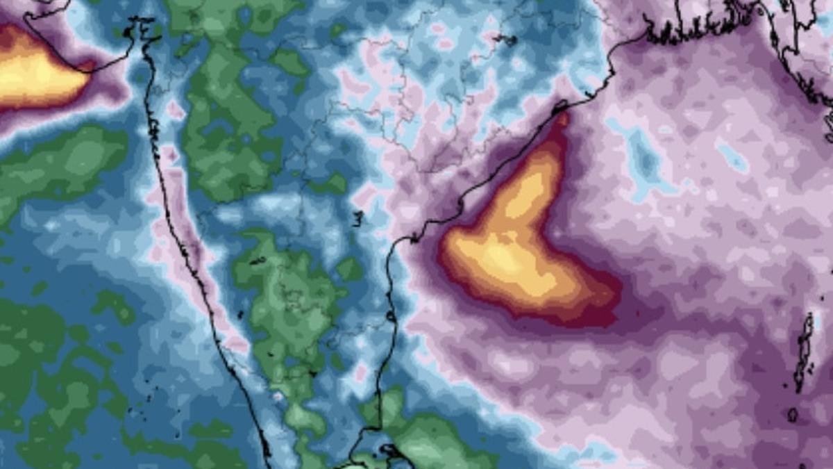
Saurashtra and Kutch as well as Coastal Andhra Pradesh may witness heaviest of rainfall until the weekend, according to projections by the European Centre for Medium-Range Weather Forecasts.
| Photo Credit:
www.tropicaltidbits.com
Withdrawal of south-west monsoon continues to be disrupted along a line that passes through Veraval and Bharuch (Gujarat), Ujjain (Madhya Pradesh), and Jhansi and Shahjahanpur (Uttar Pradesh) with the India Meteorological Department (IMD) expecting no further progress during the next seven days.
Withdrawal has been stalled for the time being by an erstwhile depression over the Bay of Bengal now settled after a round of weakening as a well-marked low-pressure area over north Madhya Maharashtra, and dictating heavy weather to West India, including Gujarat, parts of which saw monsoon exit, as also Konkan and Mumbai.
Fresh ‘low’ likely over Bay
According to latest projections, this will likely be followed by a fresh rain-driving low-pressure area forming over north and adjoining central Bay of Bengal on two days hence on October 1 (Wednesday), vindicating projections made in these columns by three expert meteorologists/researchers from the IMD as also from abroad. Like in earlier cases, this too will evolve from a remnant circulation of a storm passing from South China Sea basin.
One more to follow
An extended outlook into the first week of October suggests that a third likely wave from the South China Sea basin will drop in a hatchling over the Bay not too long after, into the second week of the month. This will put paid to ambitions of an anti-cyclonic circulation (which hastens monsoon withdrawal) briefly developing over the Bay, and likely sustaining an extended monsoon over Central India and adjoining north peninsular India.
Likely system track
Meanwhile, on Monday morning, the IMD located the well-marked low-pressure area over north Madhya Pradesh, Maharashtra having moved to the Gulf of Cambay. It is likely to to move west-northwestwards across Saurashtra and emerge into north-east Arabian Sea by Wednesday, around the time when the next ‘low’ forms on the other side over the Bay. The system might linger over the Gulf for sometime and will likely deflect the incoming ‘low’ northwards towards West Madhya Pradesh and East Rajasthan, according to early assessments.
Rain cover extends
On Monday morning, a rain-spewing trough from the well-marked ‘low’ ran down south-east across Central India to west-central Bay across south Gujarat, Vidarbha, south Chhattisgarh, south Odisha; and north Coastal Andhra Pradesh. An upper air cyclonic circulation lay over north coastal Andhra Pradesh and neighbourhood. Another circulation is parked over over north Haryana and neighbourhood.
Meanwhile on Sunday, heavy rain lashed parts of Konkan and Goa; and Saurashtra and Kutch with Mumbai 9Colaba) receiving 10 cm until 5.30 pm. Other significant rainfall amounts received during this period are Veraval (9 cm); Mumbai Santacruz Airport (7 cm); Nashik (5 cm); and Rajkot airport (4 cm).
Heavy over West India
The IMD has warned of and isolated extremely heavy rainfall over Saurashtra & Kutch today (Monday) even as heavy rain may continue to lash Konkan and Goa and Madhya Maharashtra for next seven days; and Gujarat State for four days. Very heavy rainfall is likely over Konkan; Madhya Maharashtra; and east Gujarat Region.
Isolated very heavy rainfall is likely West Bengal on Thursday; hills of West Bengal and Sikkim on Friday; and over Bihar on both Thursday and Friday as the fresh low-pressure area evolves over the Bay. Heavy rainfall is also forecast over adjoining East-Central India and parts of Central India over the weekend, as per an IMD outlook.
Published on September 29, 2025


