

IMD Update: Fresh ‘low’ over Bay under watch for cyclone formation
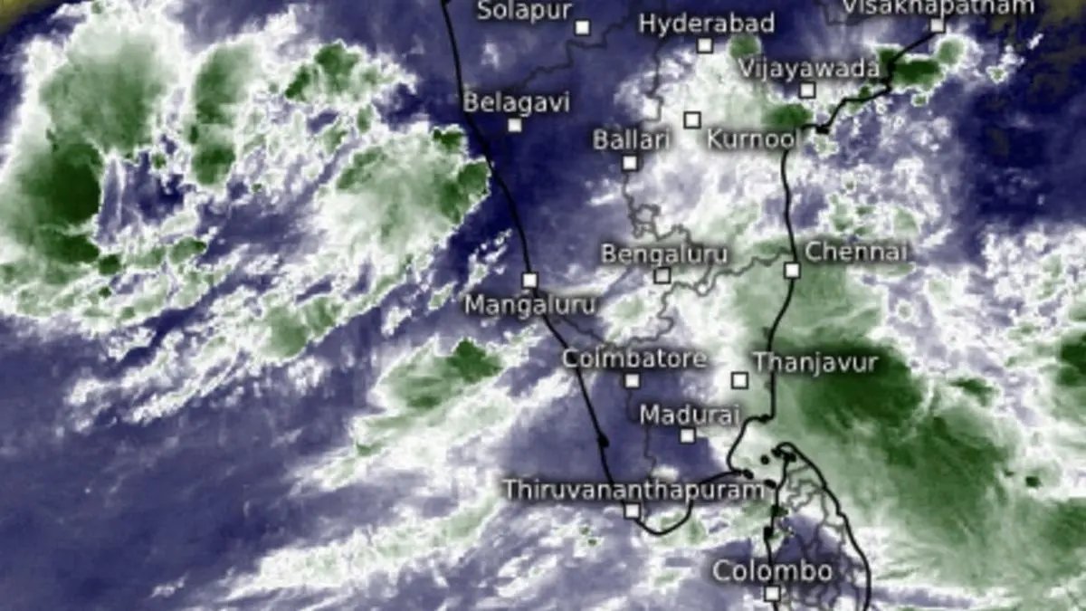

Satellite pictures showed intense clouding off the south Tamil Nadu coast as a fresh low-pressure area developed over south-east Bay of Bengal. A prevailing depression was active over Arabian Sea as well.
| Photo Credit:
www.meteologix.com/in
A fresh low-pressure area has formed, as expected, this (Friday) morning over south-east Bay of Bengal even a causative cyclonic circulation watched from above south-east Bay of Bengal and adjoining South Andaman sea.
India Meteorological Department (IMD) has put it under watch for signs of intensification, saying the system is likely to move west-northwest and become ‘more marked’ as early as by tomorrow (Saturday).
Helpful warm seas
Environmental factors for intensification are at hand with ‘boiling’ sea-surface temperatures (SSTs) of 29-30℃ along a projected track towards Tamil Nadu-south coastal Andhra Pradesh, and getting warmer towards coast.
These SSTs match with, if not exceed, those of mid-Atlantic Ocean currently hosting tropical storm Melissa. It is expected to explosively grow to the equivalent of a super cyclone, or an intense hurricane locally, tearing away at the Carribean Islands, and calibrated at Category-5 strength on Saffir-Simpson scale of storm intensity.
Hospitable environs
Closer home, winds shear values, or change in wind speed and direction with height, are projected to be low enough to secure the building storm tower over the Bay in good stead. Vorticity fields that determine the spin or helpful rotational movement of air around, is also favourable for system intensification.
Meanwhile, the depression over south-east Arabian Sea moved north-northeast and lay about 340 km north-west of Aminidivi; 430 km southwest of Panjim; and 480 km west of Mangaluru.
Depression closes in
The reclusive but stubborn system appeared to convey it means business as it shifted tracks from outer seas to move towards West Coast across east-central Arabian Sea. As was projected in these columns yesterday, it has gobbled up a remnant circulation over north Kerala from an erstwhile ‘low’ with origins in the Bay of Bengal.
Satellite maps this (Friday) morning showed skies over Tamil Nadu having largely cleared, with heavy rains occurring on the seas off south Tami Nadu as the latest ‘low’ buzzed further away over south-east Bay of Bengal. On the Arabian Sea side, the depression was flaring on the waters off Chicalim, Goa.
Rain outlook
Light to moderate rain lashed many places over Rayalaseema, and isolated places over Coastal Andhra Pradesh and Yanam even as Tamil Nadu; Kerala; and Karnataka till yesterday (Thursday) evening. As for today (Friday), heavy rain may occur during the course of the day at isolated places over Ghat areas of Coimbatore; Ranippettai; Vellore; Tiruppattur; Erode; and Nilgiris districts in Tamil Nadu.
Published on October 24, 2025
