

IMD flags severe cyclone threat for Andhra Pradesh coast
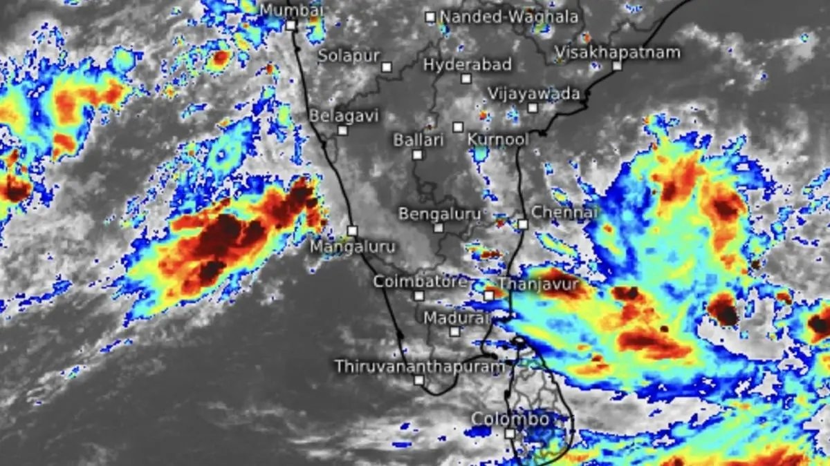

Thunderstorms and their cloud tops filled large swathes of the Arabian Sea and Bay of Bengal on Saturday evening even as the Bay is bracing to host a severe cyclone off Andhra Pradesh coast by Tuesday.
| Photo Credit:
www.meteologix.com/in
India Meteorological Department (IMD) has upgraded weather warning for Andhra Pradesh coast to that a severe cyclone, as a causative depression on Saturday set itself on a journey towards the coast from its current bearing over Bay of Bengal waters.
It was located on Saturday evening over south-east Bay about 460 km west-southwest of Port Blair; 950 km east-southeast of Chennai; 960 km south-east of Visakhapatnam; 970 km south-east of Kakinada; and 1,030 km south-southeast of Gopalpur.
Steady intensification
It may move west-northwest, intensify into a deep depression by Sunday and further into cyclone Montha over south-west and adjoining west-central Bay off north Tamil Nadu and Andhra Pradesh coast by Monday morning. Thereafter, will steer itself itself to north-west, north-northwest, and back to north-west, before intensifying into a severe cyclone by Tuesday morning.
Landfall by Tuesday night
Tracking further north-northwest, it may cross Andhra Pradesh coast between Machilipatnam and Kalingapatnam around Kakinada during evening/night of Tuesday as a severe cyclone with wind speeds of 90-100 km/hr gusting to 110 km/hr.
Extreme heavy rain
Extremely heavy rainfall has been warned of over south coastal Andhra Pradesh on Monday; over Coastal Andhra Pradesh for three days from Tuesday; over Rayalaseema on Monday and Tuesday; and also over south Odisha on Tuesday and Wednesday.
Very heavy rain
Very heavy rainfall is likely over Tamil Nadu; Kerala and Mahe; and Coastal Karnataka on Monday. Isolated very heavy rainfall is likely over Andaman and Nicobar Islands on Sunday; over Odisha for three days from Monday; and over Chhattisgarh on Wednesday.
To the East and North-East, isolated heavy rainfall is likely over Assam and Meghalaya; and Nagaland, Manipur, Mizoram and Tripura for three days from Wednesday; and Arunachal Pradesh on Thursday.
Arabian Sea depression
Meanwhile, a twin depression over east-central Arabian Sea, to the other side of the peninsula, moved west-northwest and lay centred 450 km west-northwest of Panjim; 430 km south-west of Mumbai; 680 km north-west of Mangaluru; and 690 km north-northwest of Aminidivi. It may move north-west across east-central Arabian Sea in the direction of Konkan coast till Sunday.
Rain outlook
Isolated heavy rainfall is forecast over south Konkan and Goa and south Madhya Maharashtra on Monday; over Gujarat for three days from Sunday. It will be isolated very heavy rainfall over Saurashtra on Sunday.
An incoming western disturbance is expected to pass through North-West and adjoining East India and likely interact with monsoon southwesterlies from Arabian Sea and south-easterlies from Bay systems, bringing rain to parts of these regions.
The 24 hours ending Saturday morning saw heavy to very rainfall being recorded over Goa; Tamil Nadu and Puducherry; Nicobar Island; and Coastal Karnantaka while it was heavy over Rayalaseema; Coastal Andhra Pradesh; and North Interior Karnataka.
Published on October 25, 2025
