


Cyclone Montha, hurricane Melissa erupt in landfall, half a world apart
(PTI10_28_2025_000346A)")
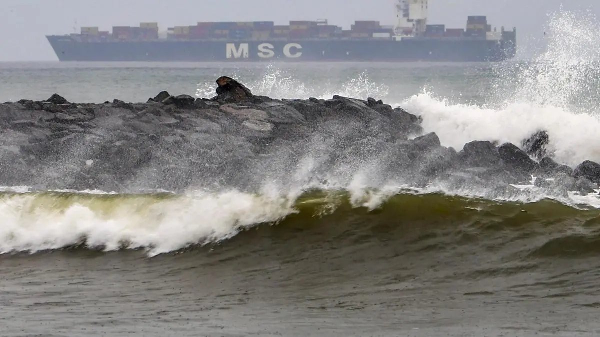
Chennai: High waves crash against the rocky shoreline as a cargo ship sails in the distance, underscoring the rough sea conditions brought on by Cyclone Montha, in Chennai, Tamil Nadu, Tuesday, Oct. 28, 2025. (PTI Photo)(PTI10_28_2025_000346A)
| Photo Credit:
–
Severe Cyclone Montha and intense category-5 hurricane Melissa in the Caribbean Sea, part of Atlantic Ocean, had pulled almost together on Tuesday for eventual landfall half a world apart – over Andhra Pradesh coast in India, and island country of Jamaica in the Caribbean, off the US.
At 3.30 pm on Tuesday, Montha over prowled west-central Bay of Bengal waters, and was located closest to coast at 60 km south-southeast of Machilipatnam;140 km south-southeast of Kakinada; 240 km south-southwest of Visakhapatnam (all Andhra Pradesh); and 480 km south-southwest of Gopalpur, as it approached for the landfall.
The storm was buffeted by maximum sustained wind speeds of 90-100 km/hr gusting to 110 km/hr, India Meteorological Department (IMD) said.
Meanwhile, dangerous hurricane Melissa closed in on Jamaica, in the Carribean Sea, part of Atlantic Ocean, to east-southeast of the US. A category-5 storm is the strongest on the Saffir-Simpson scale of storm strength and intensity.
Melissa and Montha took birth almost around the same timeline, with the former going on to grow as a monster storm, feeding on very warm waters of the Caribbean, supported by a favourable environment around the system centre.

A satellite view shows Tropical Storm Melissa, over the Caribbean Sea, October 27, 2025. CSU/CIRA & NOAA/Handout via REUTERS THIS IMAGE HAS BEEN SUPPLIED BY A THIRD PARTY. MANDATORY CREDIT. TPX IMAGES OF THE DAY
| Photo Credit: CSU/CIRA & NOAA
Melissa intensified in rapid time into strongest storm on record so far this year, and one of the strongest in the Atlantic Ocean. From Sunday afternoon through Monday afternoon local time, its peak winds spiked from 224 km/hr to 280 km/hr.
Back home, a depression over east-central Arabian Sea with an extended lifecycle, moved north-east on Tuesday and lay about 480 km south-west of Veraval; 530 km west-southwest of Mumbai; 630 km west-northwest of Panjim; 840 km northwest of Aminidivi; about 870 km north-west of Mangaluru. It may move nearly north-eastwards (facing the West Coast) until Wednesday.
Severe cyclone Montha, in combination with this depression and an itinerant western disturbance, have brought an unseasonal wet spell to many parts of West, Central and East India, apart from the South Peninsula where the north-east monsoon is active.
Heavy to very heavy rainfall is likely at a few places over Coastal Andhra Pradesh and Yanam with extremely heavy rainfall (> 20 cm) at isolated places till Wednesday. Very heavy rainfall is likely over Telangana; Rayalaseema; Vidarbha and Chhattisgarh on Wednesday; and over East Madhya Pradesh on Thursday.
Over West India, heavy rainfall is likely over Konkan and Goa; Marathawada; Madhya Maharashtra; and east Gujarat on Wednesday while it will be very heavy rain over Saurashtra and Kutch for three days from Wednesday.
Published on October 28, 2025
