









How Vehicle-Sensed Road Intelligence Could Make Every Journey Safer
Introduction
Most navigation apps are designed to answer one question:
“What’s the fastest route?”
But speed is only one part of a safe journey.
Drivers frequently encounter potholes, damaged roads, flooded streets, construction zones, and accident-prone stretches with little or no warning. These hazards often appear unexpectedly, increasing the risk of accidents, vehicle damage, and stressful driving experiences.
Despite advances in digital navigation, road safety intelligence remains largely absent from mainstream mapping platforms.
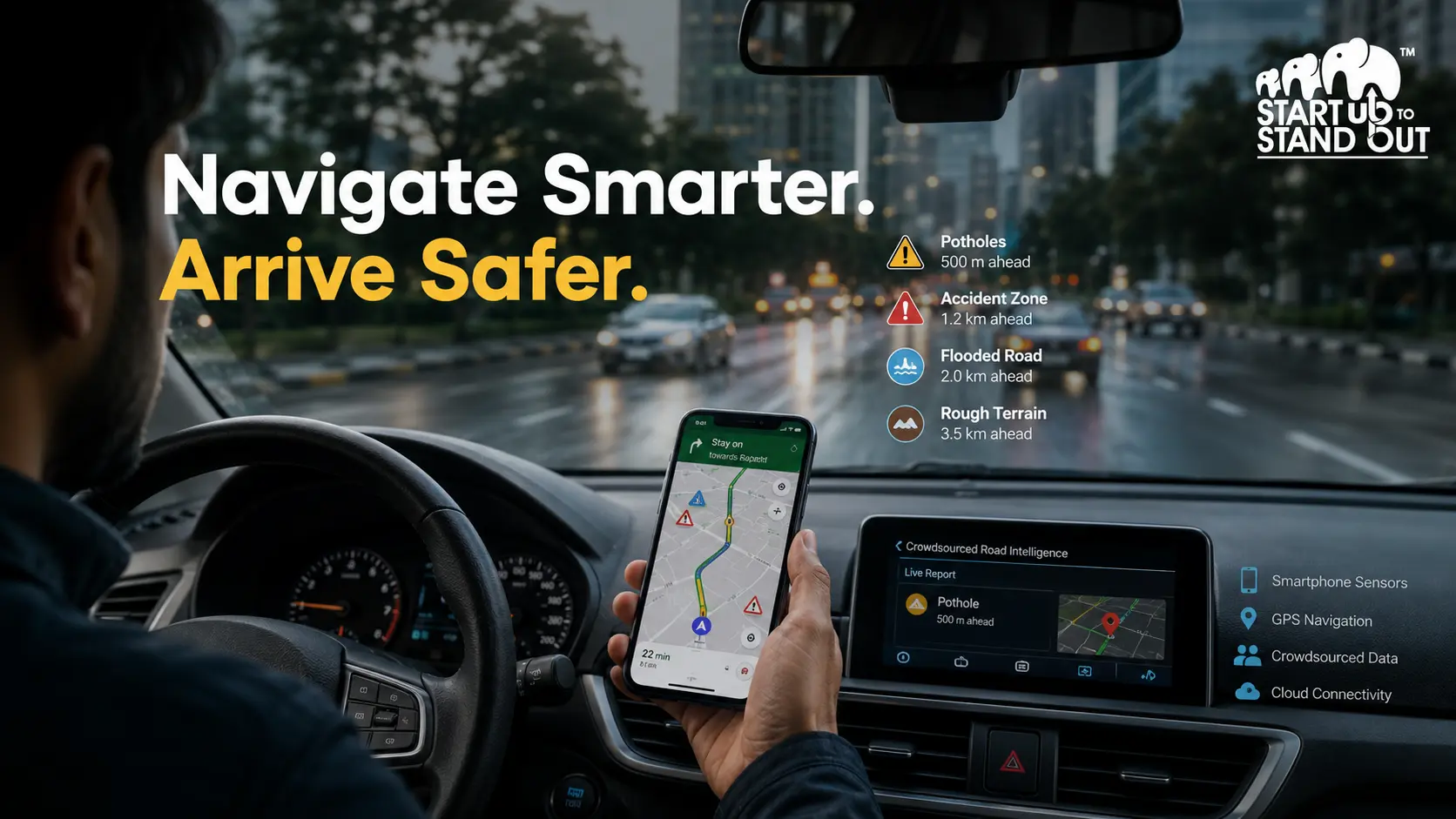
The proposed Vehicle-Sensed Road Risk Visualization System addresses this gap by transforming smartphones into real-time road safety sensors. Using built-in GPS, motion sensors, and crowdsourced data, the platform identifies hazardous road conditions and warns drivers before they encounter them, shifting navigation from simply finding the quickest route to finding the safest one.
Why Current Navigation Falls Short
Modern navigation systems excel at optimizing travel time.
However, they rarely account for rapidly changing road conditions.
Drivers often receive no advance warning about:
- Deep potholes
- Waterlogged roads
- Uneven surfaces
- Dangerous mountain roads
- Accident-prone locations
For professional drivers—including cab operators, delivery personnel, and fleet operators—these hazards are encountered daily, resulting in increased accident risks, higher maintenance costs, and operational inefficiencies.
Turning Smartphones Into Road Safety Sensors
The proposed platform leverages technology already available in nearly every smartphone.
Using built-in sensors such as:
- GPS
- Accelerometers
the application continuously analyzes vehicle movement to detect irregular road conditions.
When multiple users report similar disturbances at the same location, the platform validates the information through a crowdsourced intelligence model, improving both accuracy and reliability.
This approach eliminates the need for expensive roadside hardware while making the solution highly scalable.
From Road Data to Actionable Safety Intelligence
Simply collecting road data is not enough.
The platform transforms raw sensor information into meaningful guidance through a dynamic risk scoring system.
Each road segment is evaluated based on:
- Severity of road conditions
- Frequency of reported incidents
- Confidence level derived from multiple users
Drivers then receive real-time alerts about potential hazards before reaching dangerous locations, enabling safer driving decisions.
Serving Multiple Stakeholders
The platform creates value across several customer groups.
Individual Drivers
Safer daily commuting with advance warnings about hazardous roads.
Professional Drivers
Reduced vehicle wear, fewer accidents, and improved operational efficiency.
Logistics & Fleet Companies
Better route planning while minimizing maintenance and downtime.
Government & Smart City Authorities
Access to real-time road condition intelligence that supports infrastructure planning.
Insurance Companies
Improved risk assessment through aggregated road safety data.
This diversified customer base strengthens both commercial potential and long-term scalability.
Building a Data-Driven Mobility Platform
Delivering real-time safety intelligence requires several core capabilities.
Key activities include:
- Mobile application development
- Risk analysis algorithm development
- Cloud-based data processing
- Continuous system improvements
- User experience optimization
The platform relies on essential resources such as smartphone sensors, cloud infrastructure, software development tools, mapping APIs, and a skilled technical team specializing in software engineering and data analytics.
Strategic Partnerships Enable Scale
No mobility platform grows in isolation.
The proposed system benefits from collaborations with:
- Navigation platform providers
- Government transportation authorities
- Cloud infrastructure providers
- Smartphone manufacturers
- Automotive companies
- Fleet operators
These partnerships improve data quality, expand adoption, and accelerate nationwide deployment.
A Diversified Revenue Model
The business combines multiple revenue streams to support sustainable growth.
Revenue opportunities include:
Freemium Subscriptions
Basic safety features remain free while advanced analytics and premium routing capabilities are available through paid plans.
API Licensing
Third-party navigation platforms can integrate road risk intelligence.
Government Data Services
Aggregated infrastructure insights support smart city initiatives.
Fleet Partnerships
Commercial agreements with logistics and transportation companies.
Advertising & Data Monetization
Targeted promotions and anonymized analytical insights create additional revenue opportunities.
This diversified structure reduces dependence on any single source of income.
Future Opportunities
The platform has significant room for expansion.
Potential future developments include:
- AI-powered accident prediction
- Smart city integration
- Advanced insurance risk analytics
- International deployment
- Predictive infrastructure maintenance
As road intelligence improves, the platform evolves from a navigation application into an essential component of connected transportation infrastructure.
Insights & Analysis
The most important innovation is not navigation.
Navigation already exists.
The true value lies in transforming millions of smartphones into a distributed road intelligence network.
Every journey contributes fresh information.
Every driver strengthens the accuracy of the system.
Every reported hazard improves safety for future travelers.
This creates a powerful data network where the platform becomes increasingly valuable as adoption grows.
Rather than helping drivers arrive faster, it helps them arrive safely—a value proposition that becomes more important as urban mobility continues to evolve.
Conclusion
Road safety remains one of the most pressing transportation challenges worldwide.
While existing navigation platforms focus primarily on efficiency, the Vehicle-Sensed Road Risk Visualization System introduces a fundamentally different approach by prioritizing safety through real-time intelligence.
By combining smartphone sensors, crowdsourced reporting, cloud analytics, and predictive risk scoring, the platform creates a scalable solution capable of reducing accidents, lowering vehicle maintenance costs, and improving the overall driving experience.
As connected mobility and smart city initiatives continue to expand, platforms that transform everyday devices into intelligent safety networks may become a vital part of the future of transportation.
The smartest route is not always the shortest—it is the safest.