

Monsoon may withdraw from North-West as fresh ‘low’ forms over Bay
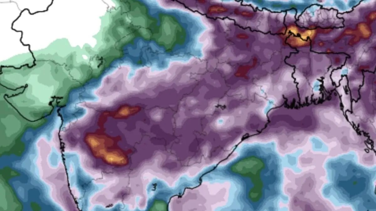

Monsoon may withdraw from parts of Rajasthan and Punjab during the next week but the process may get stalled as successor lower-pressure areas brings a fresh of heavy rain over East and North-East India; Central India and parts of West Coast.
| Photo Credit:
www.tropicaltidbits.com
Conditions are becoming favourable for withdrawal of south-west monsoon from some parts of West Rajasthan in the next three days (around September 15, two days earlier than normal) even as India Meteorological Department (IMD) declared formation of a rain-driving low-pressure area over west central and adjoining Bay of Bengal off north Andhra Pradesh and south Odisha coast.
The week from September 18 said may see fairly widespread to widespread rainfall with isolated heavy falls may lash most parts of North-East and adjoining east India. It will be fairly widespread to widespread with isolated heavy falls over Central and adjoining north Peninsular India (especially Madhya Pradesh, Gujarat and Maharashtra). Overall, rainfall activity is likely to be normal to above normal over North-West and Central India and South Peninsula; near normal over East and North-East India. during this week.
Rains may last elsewhere
This sits well in agreement with observations by three leading meteorologists/scientists that the monsoon might just be able to sustain itself despite the possibility it ight start to withdraw from extreme North-West India around its normal time.The IMD had a few years ago recalibrated from September 1 to 17 the normal date of withdrawal from these parts.
Successor ‘low’ seen
The IMD said the ‘low’ is expected to move west-northwestwards across south Odisha and adjoining north Andhra Pradesh and south Chhattisgarh during next two days. Its location and projected track are ideal for generating a fresh spell of rainfall over many parts of the four main geographical regions of the country in the south, north, west and east over next few days. Numerical models suggest formation of a stronger low-pressure area over north Andhra Pradesh-Odisha coasts in next 5-7 days.
Monsoon trough active
The core monsoon trough passed through Amritsar, Muzaffarnagar, Hardoi, Daltonganj, centre of the ‘low’ over west-central and adjoining north-west Bay off north Andhra Pradesh and south Odisha. As secondary trough runs from the ‘low’ to south Maharashtra across Chhattisgarh and Vidarbha while another helpful circulation hung over north-west Arabian Sea. This apart, a western disturbance was parked as circulation over over Himachal Prades and another circulation over north Haryana.
Helpful Circulations
To the east, helpful circulations persisted over north-east Jharkhand and Tripura. South Peninsula appears to benefit most from these settings with the IMD predicting isolated heavy rainfall likely over Tamil Nadu on Friday and later on Tuesday and Wednesday net week; Coastal Karnataka on Saturday and for three days from Monday; North Interior Karnataka for three days from Friday; and South Interior Karnataka also on Friday followed by Monday and Tuesday next week.
South to benefit most
Coastal Andhra Pradesh and Yanam as well as Rayalaseema would receive rains both on Friday and Saturday; Telangana for four days from Friday; with very heavy falls over coastal Andhra Pradesh and Yanam on Friday and Telangana on both Fridaya nd Saturday. Strong surface winds may prevail over coastal Andhra Pradesh and Yanam and Rayalaseema for next five days.
Over East and Central India, isolated very heavy falls are likely over Odisha on Friday; over Bihar on Saturday; and along the hills of West Bengal and Sikkim on Saturday and Sunday. As for North-East India, very heavy falls are likely over Assam and Meghalaya for five days from Friday; and across Nagaland, Manipur, Mizoram and Tripura for four days from Friday, the IMD said.
West and North-West
To the West, very heavy rains may lash Marathawada on Saturday; Konkan and Goa and Madhya Maharashtra on Sunday and Monday. In the adjoining North-West India, the monsoon will likely have its last hurrah with very heavy falls over Uttarakhand on Friday and Saturday; and isolated heavy over Himachal Pradesh the same days; over Uttarakhand for five days from Friday; during Haryana and Chandigarh on Saturday; East Uttar Pradesh for three days from Monday; and Punjab on Wednesday and Thursday.
Published on September 12, 2025
